Ordnance Survey Explorer OL41 Map Forest of Bowland & Ribblesdale
Ordnance Survey Explorer OL41 Map Forest of Bowland & Ribblesdale
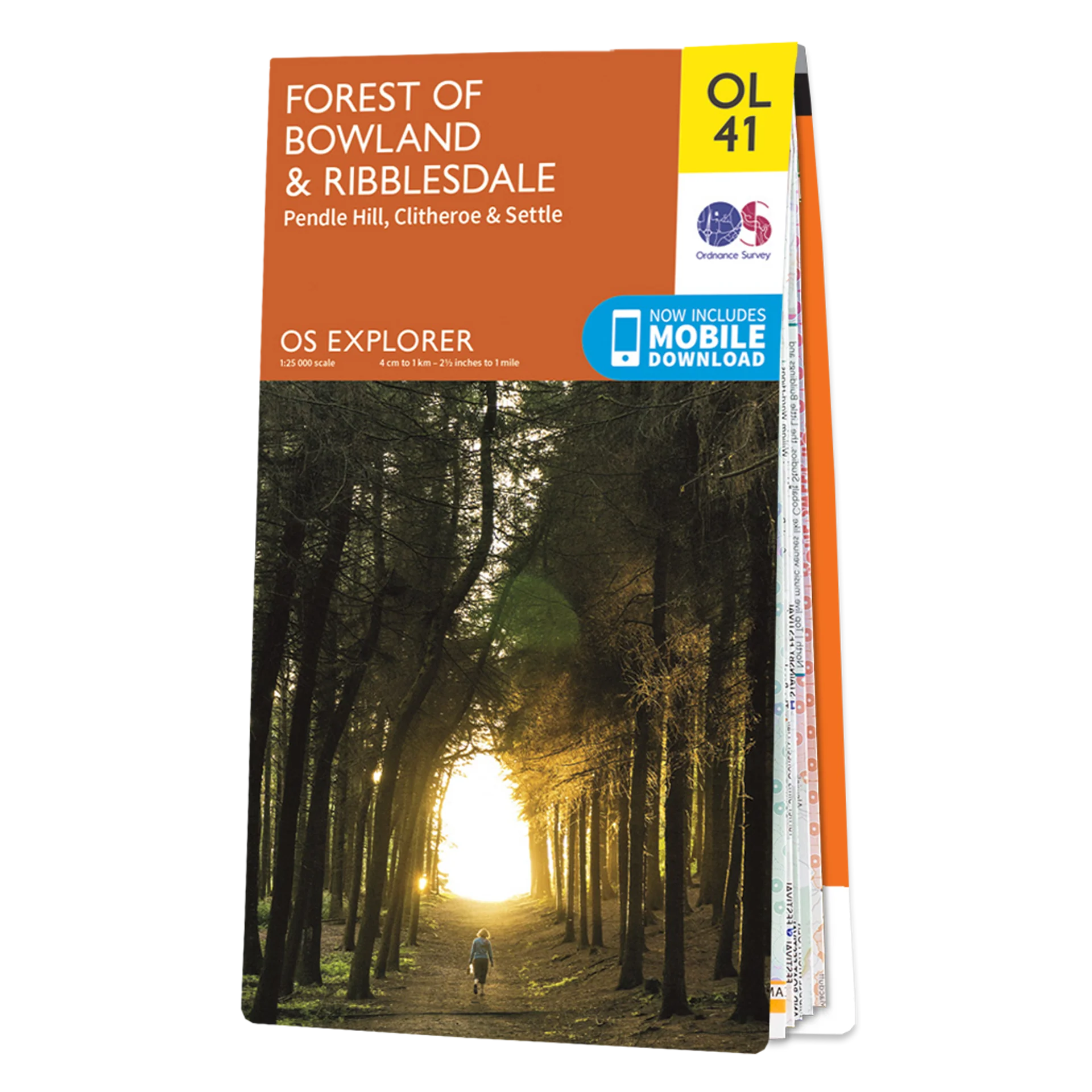
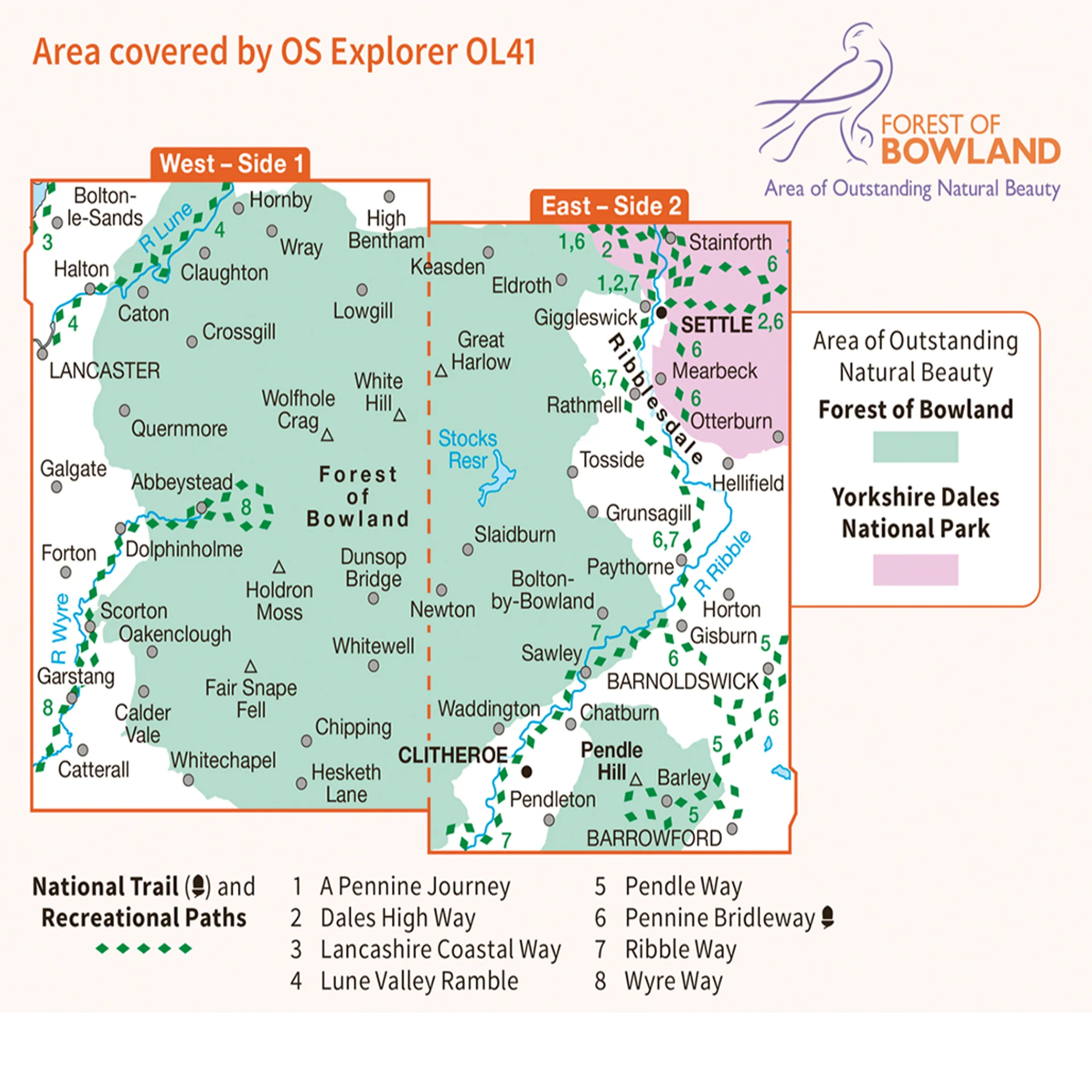
This Ordnance Survey Explorer OL41 Map is ideal for walkers, climbers, horse riding, and off-road cycling with its detailed paper folded map. Whether you're exploring, Forest of Bowland & Ribblesdale Pendle Hill, Clitheroe & Settle , you'll have all the information you need at your fingertips. Rights of way, fences, permissive paths and bridleways are clearly shown, ensuring you have the best information to get the most out of your time in the countryside. Perfect for outdoor enthusiasts.
This map now comes with a digital version which you can download to your smartphone or tablet.
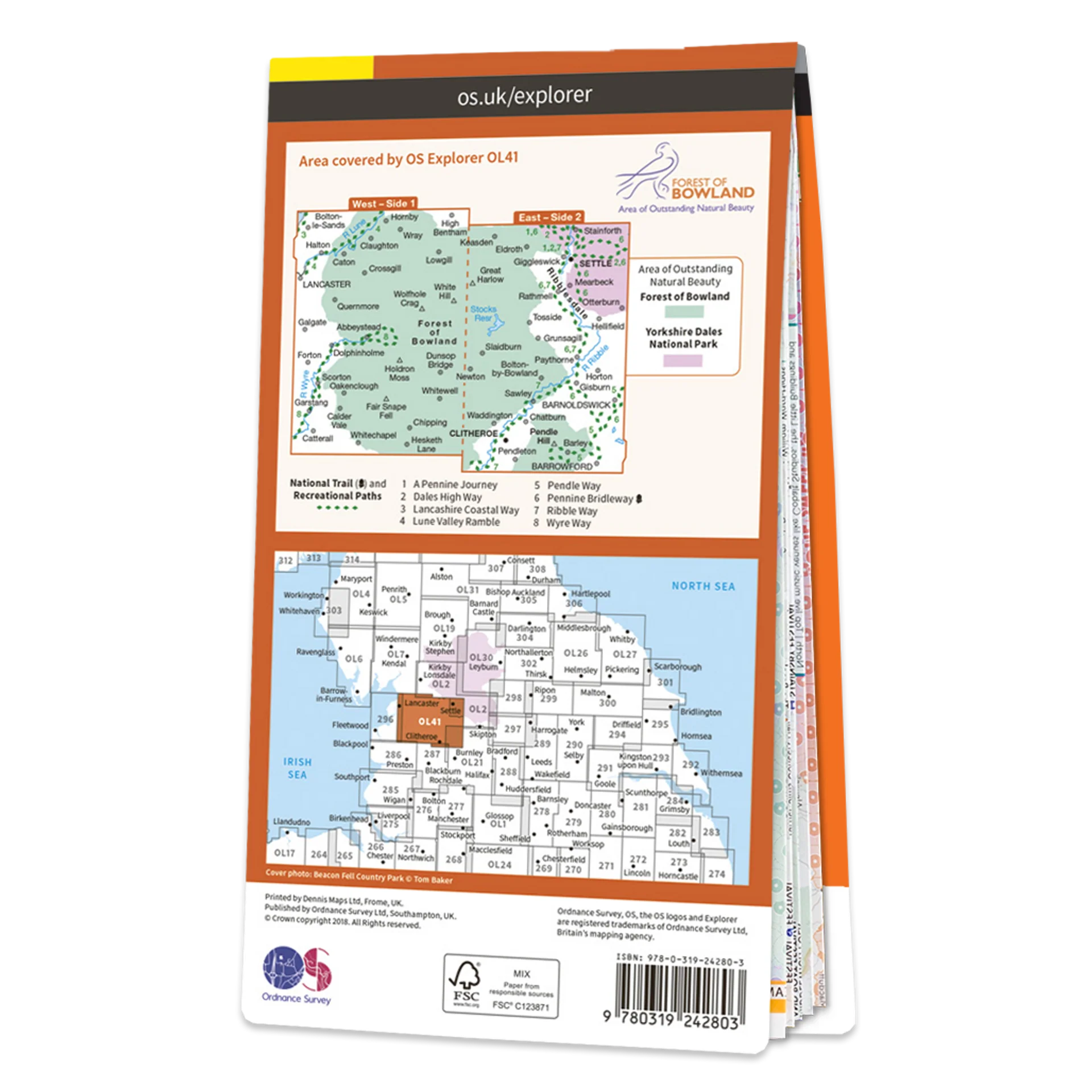
Explorer OL41 of displays the Forest of Bowland and Yorkshire Dales National Park near Clitheroe.
Featuring:
- Pennine Way
- Pendle Way
- Ribble Way
- Lancashire Coastal Way
- Lune Valley Ramble
- Pennine Way (National Trail)
- Clitheroe
- Lancaster
- Settle
- North Yorkshire
- Lancashire
- 1:25 000 scale (4 cm to 1 km – 2.5 inches to 1 mile)
Forest of Bowland & Ribblesdale Pendle Hill, Clitheroe & Settle
Product Information
Product Information
Shipping & Returns
Shipping & Returns
Ordnance Survey Explorer OL41 Map Forest of Bowland & Ribblesdale
Ordnance Survey Explorer OL41 Map Forest of Bowland & Ribblesdale
Ordnance Survey Explorer OL41 Map Forest of Bowland & Ribblesdale
This Ordnance Survey Explorer OL41 Map is ideal for walkers, climbers, horse riding, and off-road cycling with its detailed paper folded map. Whether you're exploring, Forest of Bowland & Ribblesdale Pendle Hill, Clitheroe & Settle , you'll have all the information you need at your fingertips. Rights of way, fences, permissive paths and bridleways are clearly shown, ensuring you have the best information to get the most out of your time in the countryside. Perfect for outdoor enthusiasts.
This map now comes with a digital version which you can download to your smartphone or tablet.
Explorer OL41 of displays the Forest of Bowland and Yorkshire Dales National Park near Clitheroe.
Featuring:
- Pennine Way
- Pendle Way
- Ribble Way
- Lancashire Coastal Way
- Lune Valley Ramble
- Pennine Way (National Trail)
- Clitheroe
- Lancaster
- Settle
- North Yorkshire
- Lancashire
- 1:25 000 scale (4 cm to 1 km – 2.5 inches to 1 mile)
Forest of Bowland & Ribblesdale Pendle Hill, Clitheroe & Settle
Original: $13.60
-65%$13.60
$4.76Product Information
Product Information
Shipping & Returns
Shipping & Returns
Description
Ordnance Survey Explorer OL41 Map Forest of Bowland & Ribblesdale
This Ordnance Survey Explorer OL41 Map is ideal for walkers, climbers, horse riding, and off-road cycling with its detailed paper folded map. Whether you're exploring, Forest of Bowland & Ribblesdale Pendle Hill, Clitheroe & Settle , you'll have all the information you need at your fingertips. Rights of way, fences, permissive paths and bridleways are clearly shown, ensuring you have the best information to get the most out of your time in the countryside. Perfect for outdoor enthusiasts.
This map now comes with a digital version which you can download to your smartphone or tablet.
Explorer OL41 of displays the Forest of Bowland and Yorkshire Dales National Park near Clitheroe.
Featuring:
- Pennine Way
- Pendle Way
- Ribble Way
- Lancashire Coastal Way
- Lune Valley Ramble
- Pennine Way (National Trail)
- Clitheroe
- Lancaster
- Settle
- North Yorkshire
- Lancashire
- 1:25 000 scale (4 cm to 1 km – 2.5 inches to 1 mile)
Forest of Bowland & Ribblesdale Pendle Hill, Clitheroe & Settle