Ordnance Survey Explorer OL40 Map The Broads
Ordnance Survey Explorer OL40 Map The Broads
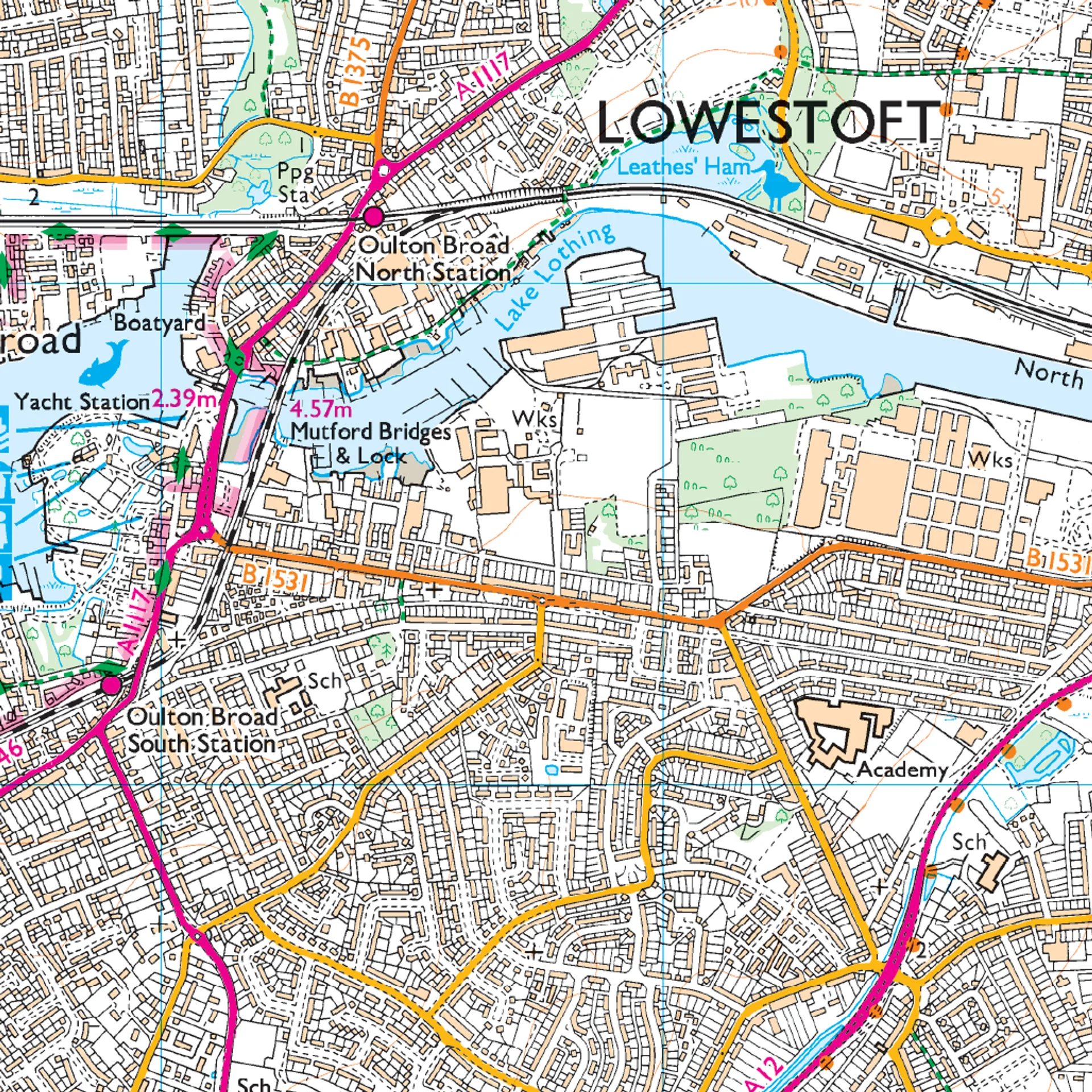
This Ordnance Survey Explorer OL40 Map is ideal for walkers, climbers, horse riding, and off-road cycling with its detailed paper folded map. Whether you're exploring, the Norfolk Boards, Wroxham, Beccles, Lowestoft and Great Yarmouth, you'll have all the information you need at your fingertips. Rights of way, fences, permissive paths and bridleways are clearly shown, ensuring you have the best information to get the most out of your time in the countryside. Perfect for outdoor enthusiasts.
This map now comes with a digital version which you can download to your smartphone or tablet.
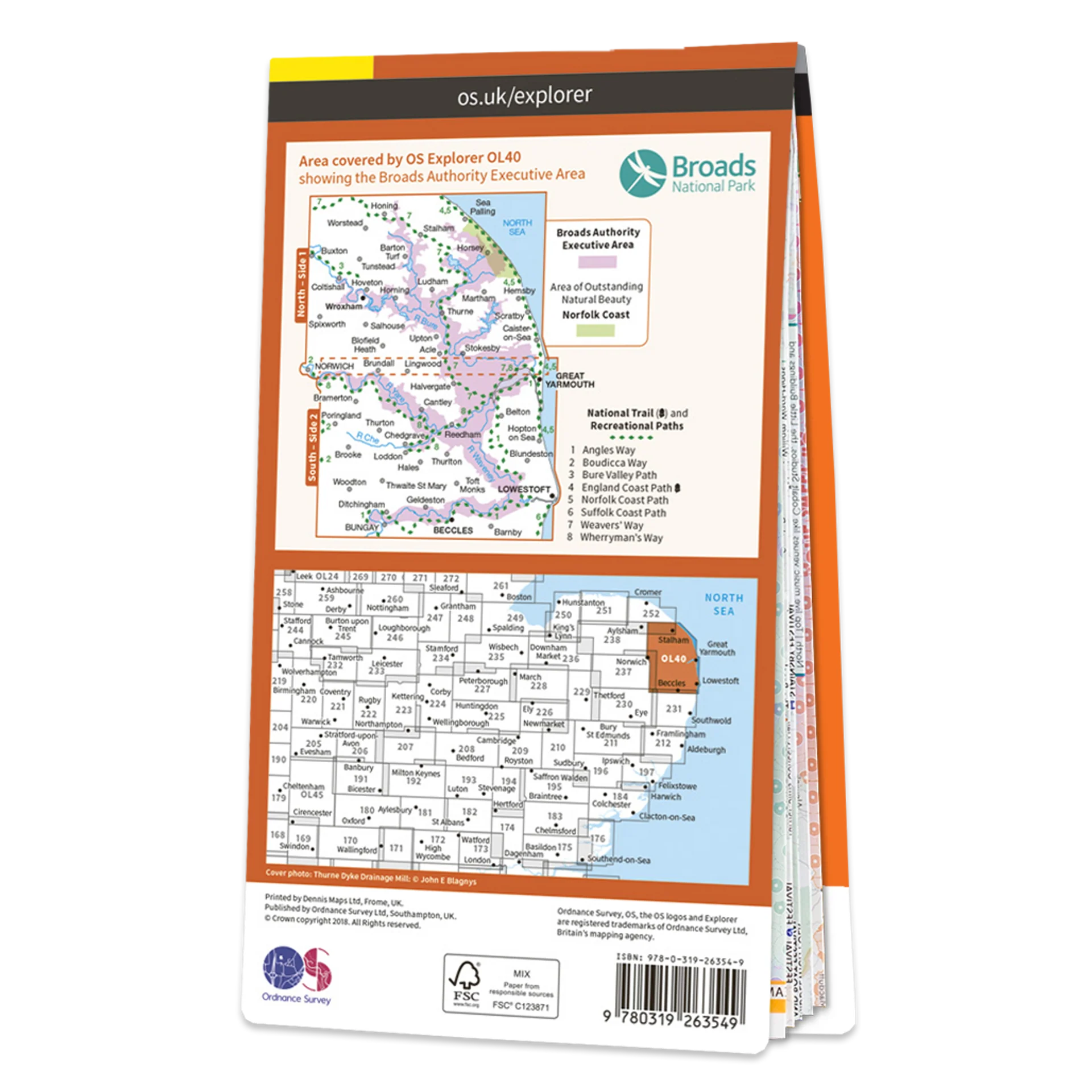
The OS OL40 Explorer map of the Broads; a member of the national park family, it features the rivers: Burne, Ant, Thurne, Yare, Chet, and Waveney. The map also includes the Norfolk and Suffolk coasts, as well as the seaside towns of Great Yarmouth
Featuring:
- Weavers' Way
- Angles Way
- Suffolk Coast Path
- Bure Valley Path
- Boudica's Way
- Beccles
- Great Yarmouth
- Lowestoft
- Norwich
- Norfolk
- Suffolk
- Norfolk Broads
- 1:25 000 scale (4 cm to 1 km – 2.5 inches to 1 mile)
Product Information
Product Information
Shipping & Returns
Shipping & Returns


Ordnance Survey Explorer OL40 Map The Broads
Ordnance Survey Explorer OL40 Map The Broads
Ordnance Survey Explorer OL40 Map The Broads
This Ordnance Survey Explorer OL40 Map is ideal for walkers, climbers, horse riding, and off-road cycling with its detailed paper folded map. Whether you're exploring, the Norfolk Boards, Wroxham, Beccles, Lowestoft and Great Yarmouth, you'll have all the information you need at your fingertips. Rights of way, fences, permissive paths and bridleways are clearly shown, ensuring you have the best information to get the most out of your time in the countryside. Perfect for outdoor enthusiasts.
This map now comes with a digital version which you can download to your smartphone or tablet.
The OS OL40 Explorer map of the Broads; a member of the national park family, it features the rivers: Burne, Ant, Thurne, Yare, Chet, and Waveney. The map also includes the Norfolk and Suffolk coasts, as well as the seaside towns of Great Yarmouth
Featuring:
- Weavers' Way
- Angles Way
- Suffolk Coast Path
- Bure Valley Path
- Boudica's Way
- Beccles
- Great Yarmouth
- Lowestoft
- Norwich
- Norfolk
- Suffolk
- Norfolk Broads
- 1:25 000 scale (4 cm to 1 km – 2.5 inches to 1 mile)
Original: $13.60
-65%$13.60
$4.76Product Information
Product Information
Shipping & Returns
Shipping & Returns
Description
Ordnance Survey Explorer OL40 Map The Broads
This Ordnance Survey Explorer OL40 Map is ideal for walkers, climbers, horse riding, and off-road cycling with its detailed paper folded map. Whether you're exploring, the Norfolk Boards, Wroxham, Beccles, Lowestoft and Great Yarmouth, you'll have all the information you need at your fingertips. Rights of way, fences, permissive paths and bridleways are clearly shown, ensuring you have the best information to get the most out of your time in the countryside. Perfect for outdoor enthusiasts.
This map now comes with a digital version which you can download to your smartphone or tablet.
The OS OL40 Explorer map of the Broads; a member of the national park family, it features the rivers: Burne, Ant, Thurne, Yare, Chet, and Waveney. The map also includes the Norfolk and Suffolk coasts, as well as the seaside towns of Great Yarmouth
Featuring:
- Weavers' Way
- Angles Way
- Suffolk Coast Path
- Bure Valley Path
- Boudica's Way
- Beccles
- Great Yarmouth
- Lowestoft
- Norwich
- Norfolk
- Suffolk
- Norfolk Broads
- 1:25 000 scale (4 cm to 1 km – 2.5 inches to 1 mile)