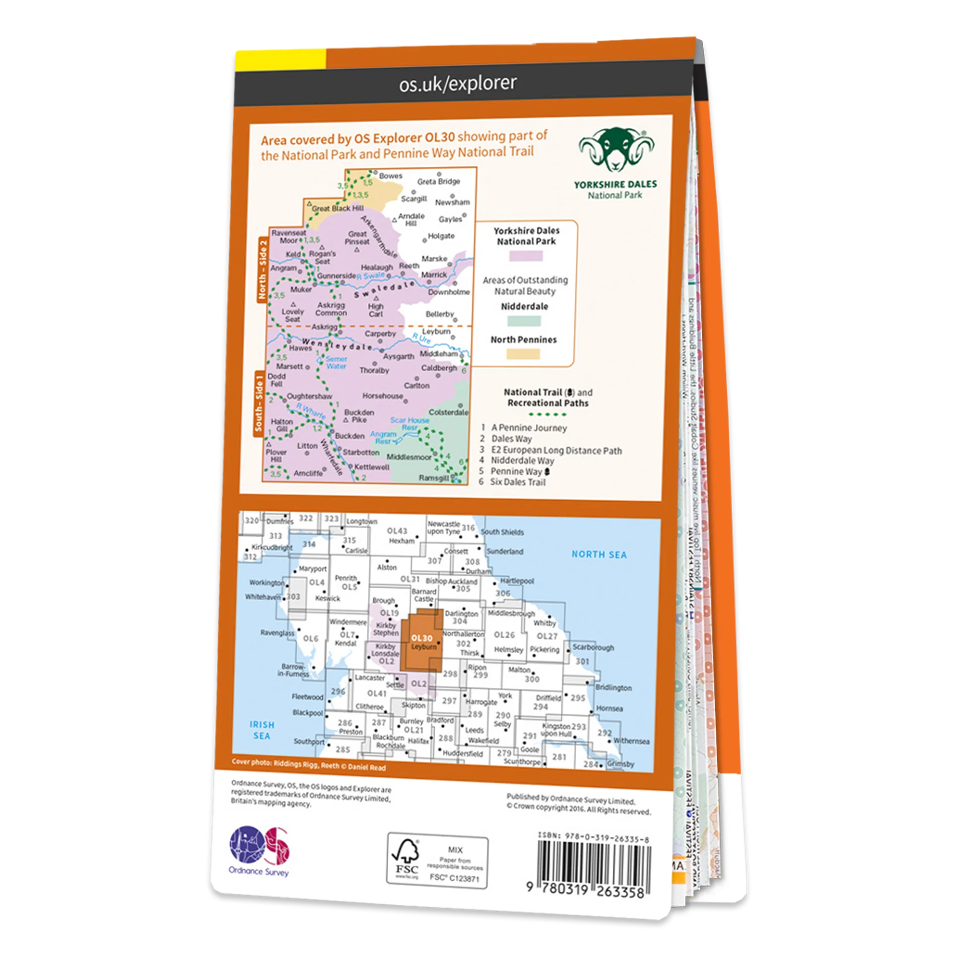
Ordnance Survey Explorer OL30 Map Yorkshire Dales Northern & Central Areas
Ordnance Survey Explorer OL30 Map Yorkshire Dales
This Ordnance Survey Explorer OL30 Map is ideal for walkers, climbers, horse riding, and off-road cycling with its detailed paper folded map. Whether you're exploring, Northern & Central Areas of the Yorkshire Dales, Wensleydale & Swaledale you'll have all the information you need at your fingertips. Rights of way, fences, permissive paths and bridleways are clearly shown, ensuring you have the best information to get the most out of your time in the countryside. Perfect for outdoor enthusiasts.
This map now comes with a digital version which you can download to your smartphone or tablet.
Explore the northernmost dale of Swaledale — the dale of the river Swale, or checkout Wensleydale — famous for its cheese of the same name. Other highlights include: Arkengarthdale Valley, Aysgarth Falls, Hawes, and the River Wharfe.
Featuring:
- Pennine Way
- Dales Way
- Dales Way (Guide Book)
- Nidderdale Way
- Pennine Way (National Trail)
- E2 (European Long Distance Route)
- Yorkshire Dales National Park
- North Yorkshire
- Durham
- 1:25 000 scale (4 cm to 1 km – 2.5 inches to 1 mile)
Product Information
Product Information
Shipping & Returns
Shipping & Returns


Ordnance Survey Explorer OL30 Map Yorkshire Dales Northern & Central Areas
Ordnance Survey Explorer OL30 Map Yorkshire Dales Northern & Central Areas
Ordnance Survey Explorer OL30 Map Yorkshire Dales
This Ordnance Survey Explorer OL30 Map is ideal for walkers, climbers, horse riding, and off-road cycling with its detailed paper folded map. Whether you're exploring, Northern & Central Areas of the Yorkshire Dales, Wensleydale & Swaledale you'll have all the information you need at your fingertips. Rights of way, fences, permissive paths and bridleways are clearly shown, ensuring you have the best information to get the most out of your time in the countryside. Perfect for outdoor enthusiasts.
This map now comes with a digital version which you can download to your smartphone or tablet.
Explore the northernmost dale of Swaledale — the dale of the river Swale, or checkout Wensleydale — famous for its cheese of the same name. Other highlights include: Arkengarthdale Valley, Aysgarth Falls, Hawes, and the River Wharfe.
Featuring:
- Pennine Way
- Dales Way
- Dales Way (Guide Book)
- Nidderdale Way
- Pennine Way (National Trail)
- E2 (European Long Distance Route)
- Yorkshire Dales National Park
- North Yorkshire
- Durham
- 1:25 000 scale (4 cm to 1 km – 2.5 inches to 1 mile)
Original: $13.60
-65%$13.60
$4.76Product Information
Product Information
Shipping & Returns
Shipping & Returns
Description
Ordnance Survey Explorer OL30 Map Yorkshire Dales
This Ordnance Survey Explorer OL30 Map is ideal for walkers, climbers, horse riding, and off-road cycling with its detailed paper folded map. Whether you're exploring, Northern & Central Areas of the Yorkshire Dales, Wensleydale & Swaledale you'll have all the information you need at your fingertips. Rights of way, fences, permissive paths and bridleways are clearly shown, ensuring you have the best information to get the most out of your time in the countryside. Perfect for outdoor enthusiasts.
This map now comes with a digital version which you can download to your smartphone or tablet.
Explore the northernmost dale of Swaledale — the dale of the river Swale, or checkout Wensleydale — famous for its cheese of the same name. Other highlights include: Arkengarthdale Valley, Aysgarth Falls, Hawes, and the River Wharfe.
Featuring:
- Pennine Way
- Dales Way
- Dales Way (Guide Book)
- Nidderdale Way
- Pennine Way (National Trail)
- E2 (European Long Distance Route)
- Yorkshire Dales National Park
- North Yorkshire
- Durham
- 1:25 000 scale (4 cm to 1 km – 2.5 inches to 1 mile)