Ordnance Survey Explorer 217 Map The Long Mynd & Wenlock Edge
Ordnance Survey Explorer 217 Map The Long Mynd & Wenlock Edge
This Ordnance Survey Explorer 217 Map is ideal for walkers, climbers, horse riding, and off-road cycling with its detailed paper folded map. Whether you're exploring The Long Mynd, Wenlock Edge, Church Stretton and Craven Arms. you'll have all the information you need at your fingertips. Rights of way, fences, permissive paths and bridleways are clearly shown, ensuring you have the best information to get the most out of your time in the countryside. Perfect for outdoor enthusiasts.
This map now comes with a digital version which you can download to your smartphone or tablet.
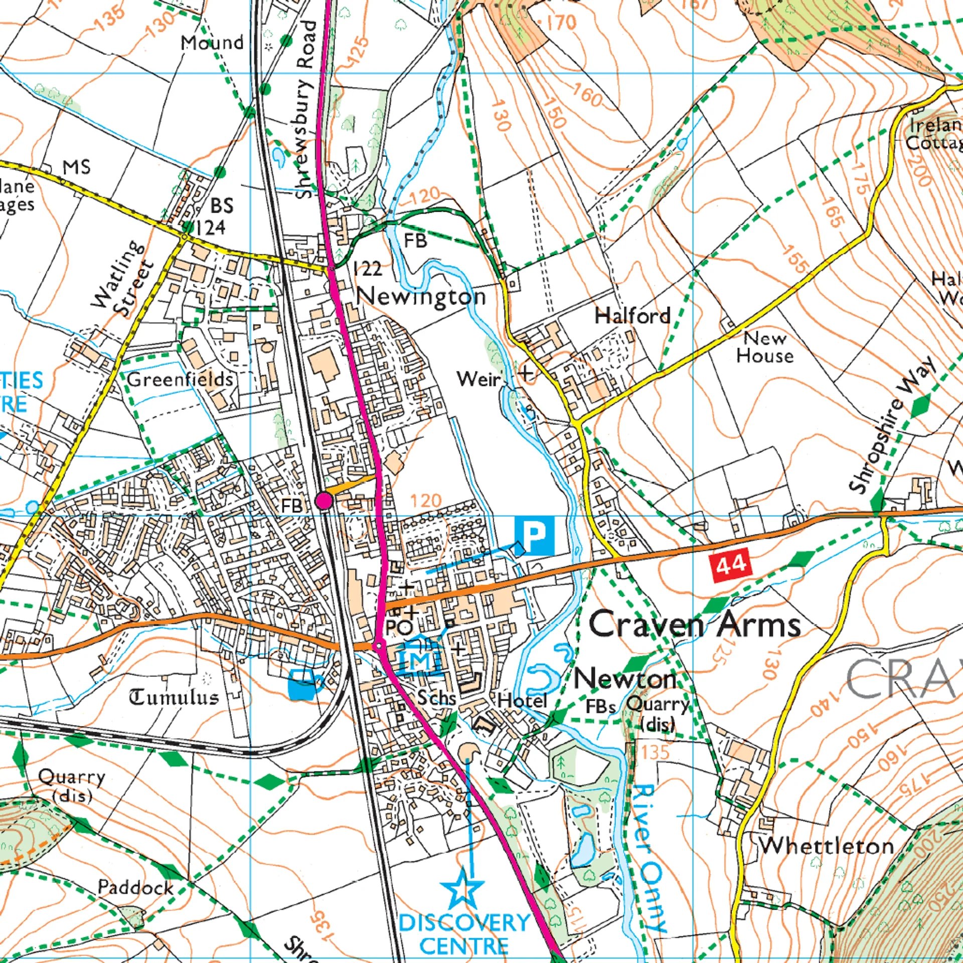
OS Explorer map 217 - The Long Mynd and Wenlock Edge, including Church Stretton and Craven Arms.
Featuring:
- Jack Mytton Way
- Shropshire Way
- Marches Way
- Format: Folded map
- 1:25 000 scale (4 cm to 1 km – 2.5 inches to 1 mile)
- Physical Size: 952 x 1270 mm (133 x 240 mm folded)
Product Information
Product Information
Shipping & Returns
Shipping & Returns


Ordnance Survey Explorer 217 Map The Long Mynd & Wenlock Edge
Ordnance Survey Explorer 217 Map The Long Mynd & Wenlock Edge
Ordnance Survey Explorer 217 Map The Long Mynd & Wenlock Edge
This Ordnance Survey Explorer 217 Map is ideal for walkers, climbers, horse riding, and off-road cycling with its detailed paper folded map. Whether you're exploring The Long Mynd, Wenlock Edge, Church Stretton and Craven Arms. you'll have all the information you need at your fingertips. Rights of way, fences, permissive paths and bridleways are clearly shown, ensuring you have the best information to get the most out of your time in the countryside. Perfect for outdoor enthusiasts.
This map now comes with a digital version which you can download to your smartphone or tablet.
OS Explorer map 217 - The Long Mynd and Wenlock Edge, including Church Stretton and Craven Arms.
Featuring:
- Jack Mytton Way
- Shropshire Way
- Marches Way
- Format: Folded map
- 1:25 000 scale (4 cm to 1 km – 2.5 inches to 1 mile)
- Physical Size: 952 x 1270 mm (133 x 240 mm folded)
Product Information
Product Information
Shipping & Returns
Shipping & Returns
Description
Ordnance Survey Explorer 217 Map The Long Mynd & Wenlock Edge
This Ordnance Survey Explorer 217 Map is ideal for walkers, climbers, horse riding, and off-road cycling with its detailed paper folded map. Whether you're exploring The Long Mynd, Wenlock Edge, Church Stretton and Craven Arms. you'll have all the information you need at your fingertips. Rights of way, fences, permissive paths and bridleways are clearly shown, ensuring you have the best information to get the most out of your time in the countryside. Perfect for outdoor enthusiasts.
This map now comes with a digital version which you can download to your smartphone or tablet.
OS Explorer map 217 - The Long Mynd and Wenlock Edge, including Church Stretton and Craven Arms.
Featuring:
- Jack Mytton Way
- Shropshire Way
- Marches Way
- Format: Folded map
- 1:25 000 scale (4 cm to 1 km – 2.5 inches to 1 mile)
- Physical Size: 952 x 1270 mm (133 x 240 mm folded)